ARTIGOS
-
Mapa a la Carta
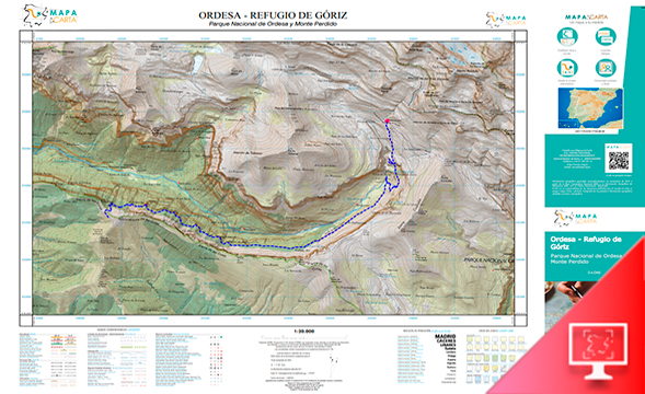
Mapa a la carta permite crear un mapa o foto aérea personalizada de alta calidad. Permite definir la zona del mapa, incorporar contenidos (rutas, imágenes o geometrías) o comentarios personalizados sobre el propio mapa. Una vez creado, se puede descargar el fichero en PDF y adquirir copias en papel. Está desarrollado con REACT y la API IDEE, software libre. Destinado al público general, muy útil en ESO y Bachillerato, aunque se puede empezar a utilizar en la última etapa de primaria, a partir...
Área de coñecementoContexto educativo -
Atlas Interactivo
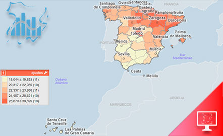
El Atlas Interactivo permite consultar datos estadísticos e indicadores principales del Atlas Nacional de España (ANE), intercambiar variables para formar un nuevo mapa y, además, incluir datos externos (propios o descargados de fuentes como el Instituto Nacional de Estadística (INE)) y visualizarlos en mapas interactivos. Está desarrollado con Géoclip. Destinado al público general, útil en ESO y Bachillerato. https://interactivo-atlasnacional.ign.es/#c=home
Área de coñecementoContexto educativo -
Iberpix

Iberpix es un visualizador cartográfico para la visualización de mapas y capas de información geográfica. Está desarrollado con la API CNIG, software libre. Destinado al público general, muy útil en ESO y Bachillerato, aunque se puede empezar a utilizar en la última etapa de primaria, a partir de 10 años. https://www.ign.es/iberpix/
Área de coñecementoContexto educativo -
La leyenda de las joyas perdidas
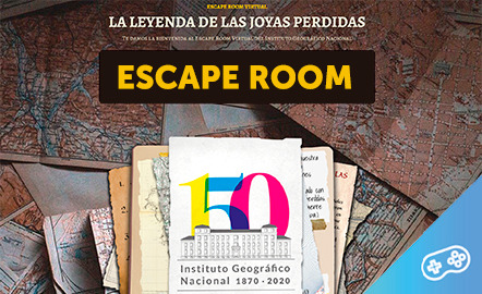
Encuentra las joyas resolviendo enigmas donde se pondrán a prueba los conocimientos cartográficos y geográficos necesarios para salir airoso de esta aventura. http://educativo.ign.es/escape-room/
Área de coñecementoContexto educativo -
GeoExplorer

GeoExplorer has come to discover the Earth through games to learn astronomy, the interior of the Earth, geography and maps. Draw, colour, cut and learn more with links to other resources. Aimed at students aged from 6 to 12 years. https://www.ign.es/web/resources/acercaDe/libDigPub/Geoexplorer_en.pdf
- mapa
- libro
- astronomía
- tierra
- terremoto
- volcán
- volcanes
- dibujo
- dibujar
- colorear
- recortar
- actividad
- cartografía
- Geografía
- juego
- jugar
- mapa
- país
- província
- región
- gamificación
- continente
- mundo
- mundial
- río
- montaña
- cordillera
- Física
- política
- bandera
- placas tectónicas
- Litosfera
- pico
- cabo
- Golfo
- isla
- archipiélago
- capital
- ciudad
- infantil
- Primaria
Área de coñecementoContexto educativo -
GeoExplorer
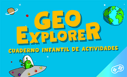
GeoExplorer ha venido a descubrir la Tierra a través de juegos para aprender astronomía, el interior de la Tierra, geografía y mapas. Dibuja, colorea, recorta y aprende más con enlaces a otros recursos. Dirigido a estudiantes de entre 6 y 12 años. https://www.ign.es/web/resources/acercaDe/libDigPub/Geoexplorer_es.pdf
- mapa
- libro
- astronomía
- tierra
- terremoto
- volcán
- volcanes
- dibujo
- dibujar
- colorear
- recortar
- actividad
- cartografía
- Geografía
- juego
- jugar
- mapa
- país
- província
- región
- gamificación
- continente
- mundo
- mundial
- río
- montaña
- cordillera
- Física
- política
- bandera
- placa
- tectónica
- Litosfera
- pico
- cabo
- Golfo
- isla
- archipiélago
- capital
- ciudad
- infantil
- Primaria
Área de coñecementoContexto educativo -
GeoSapiens App

GeoSapiens tests your knowledge of physical, political and landscape geography. Review the names of the main features of land and coastal relief, countries, capitals, regions, flags and much more. It contains games from Spain, by autonomous region, the world and by continent. Play, score points and share your results. Suitable for all ages. English and Spanish. https://www.ign.es/web/ign/portal/dir-aplicaciones-moviles
- ign
- aplicación
- app
- juego
- jugar
- gamificación
- Geografía
- cartografía
- mapa
- comunidad
- autónoma
- país
- província
- región
- regiones
- capital
- Capitales
- municipio
- territorio
- continente
- mundo
- mundial
- río
- relieve
- montaña
- cordillera
- Lago
- Embalse
- Física
- política
- bandera
- Cuenca
- hidrografía
- placas tectónicas
- fosa
- dorsal
- costa
- costero
- pico
- cabo
- Golfo
- isla
- archipiélago
- ciudad
- Zonas
- parque nacional
- natural
- protegido
- regional
- rural
- paisaje
Área de coñecementoContexto educativo -
GeoSapiens App
Aplicación móvil de mapas interactivos para estudiar la geografía física, política y el paisaje de España y el mundo. Es bilingüe en español e inglés y la mayoría de los juegos no requieren conexión a internet. Repasa los nombres de los principales accidentes del relieve terrestre y costero, los países, capitales, regiones, banderas y mucho más. Contiene juegos de España, por comunidad autónoma, del mundo y por continente. Juega y suma puntos. Dirigido a todas las edades. En español e inglés....
- ign
- aplicación
- app
- juego
- jugar
- gamificación
- Geografía
- cartografía
- mapa
- comunidad
- autónoma
- país
- província
- región
- regiones
- capital
- Capitales
- municipio
- territorio
- continente
- mundo
- mundial
- río
- relieve
- montaña
- cordillera
- Lago
- Embalse
- Física
- política
- bandera
- Cuenca
- hidrografía
- placa
- tectónica
- fosa
- dorsal
- costa
- costero
- pico
- cabo
- Golfo
- isla
- archipiélago
- ciudad
- Zonas
- proteger
- parque
- nacional
- natural
- regional
- rural
- paisaje
Área de coñecementoContexto educativo -
GeoSapiens

GeoSapiens tests your knowledge of physical, political and landscape geography. Review the names of the main features of land and coastal relief, countries, capitals, regions, flags and much more. It contains games from Spain, by autonomous region, the world and by continent. Create your customized game and share it with your class. Play, score points and share your results. Suitable for all ages. https://educativo.ign.es/geosapiens/htm/es/index.html
- aplicación
- cartografía
- comunidad autónoma
- Geografía
- juego
- jugar
- mapa
- país
- província
- región
- regiones
- territorio
- gamificación
- continente
- mundo
- mundial
- río
- montaña
- cordillera
- Lago
- Embalse
- Física
- política
- bandera
- Cuenca
- hidrografía
- placa
- tectónica
- fosa
- dorsal
- costa
- costero
- pico
- cabo
- Golfo
- isla
- archipiélago
- capital
- ciudad
Área de coñecementoContexto educativo -
GeoSapiens
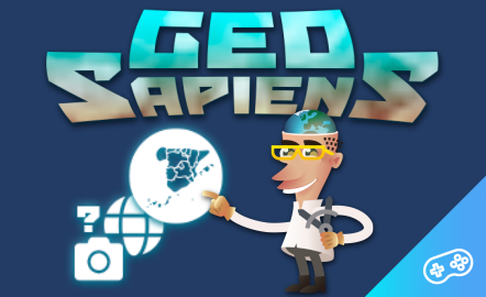
GeoSapiens pone a prueba tus conocimientos sobre geografía física, política y paisaje. Repasa los nombres de los principales accidentes del relieve terrestre y costero, los países, capitales, regiones, banderas y mucho más. Contiene juegos de España, por comunidad autónoma, del mundo y por continente. Dirigido a todas las edades. También se ofrece este recurso en inglés. https://educativo.ign.es/geosapiens/htm/es/index.html
- aplicación
- cartografía
- comunidad autónoma
- Geografía
- juego
- jugar
- mapa
- país
- província
- región
- regiones
- territorio
- gamificación
- continente
- mundo
- mundial
- río
- cordillera
- Lago
- Embalse
- Física
- política
- bandera
- Cuenca
- hidrografía
- placa
- tectónica
- fosa
- dorsal
- costa
- costero
- pico
- cabo
- Golfo
- isla
- archipiélago
- capital
- ciudad
Área de coñecementoContexto educativo -
Orientation in the field with map, compass and apps
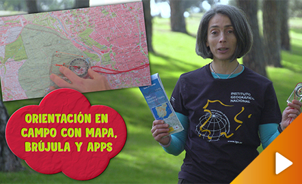
This video shows how to orient yourself in the field in a traditional way through the use of a map and a compass, and through the use of map applications for mobile devices. The video includes a test as a quiz to check what has been learned, which can be found in the descriptive text located below it. https://www.youtube.com/watch?v=xE4edPN3OEo&feature=youtu.be
Área de coñecementoContexto educativo -
Geolocation by satellite, what is it and how it works?
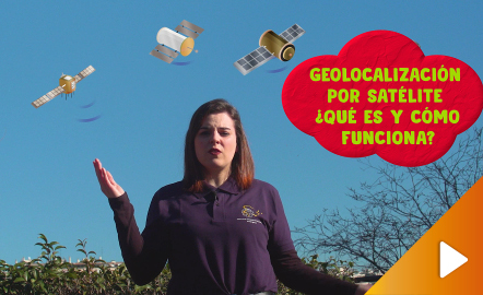
In this video GNSS technology foundations and use are explained, and also how it is used in mobile and in other more accurate applications, such as cartography or Earth dynamics knowledge. The video includes a test as a quiz to check what has been learned, which can be found in the descriptive text located below it. https://www.youtube.com/watch?v=LA3KeMDFIhQ&feature=youtu.be
Área de coñecementoContexto educativo -
Map reading
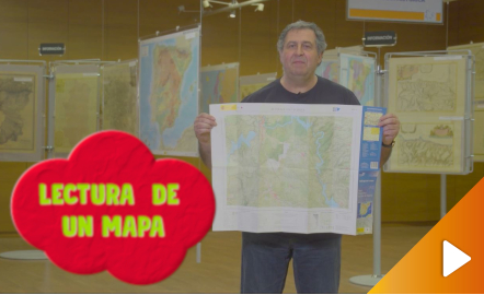
All the clues for understanding symbols, scale and relief of the National Topographic Map are in this video. The video includes a test as a quiz to check what has been learned, which can be found in the descriptive text located below it. https://youtu.be/kx2Bit8te1s
Área de coñecementoContexto educativo -
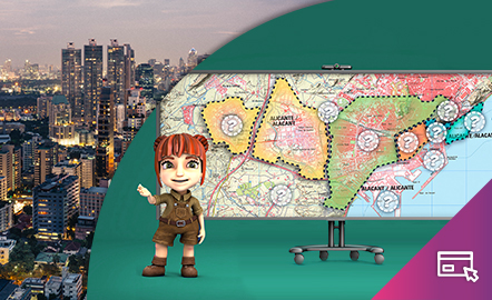
The city

The aim of this interactive teaching and learning resource is to differentiate between urban spaces and their different features by reading a map. The medium used is a game in which the different areas of the city are shown and, according to the characteristics indicated, the user must point to them on the map. Aimed at students aged from 12 to 16 years. Year of creation: 2020. https://www.ign.es/recursos-educativos/descubre-territorio/ciudad.html
Área de coñecementoContexto educativo -
La ciudad
Este recurso interactivo y didáctico tiene como objetivo diferenciar los espacios urbanos y sus diferentes funciones mediante la lectura cartográfica. El soporte es un juego en el que se van explicando las diferentes zonas de la ciudad y el usuario, según las características indicadas, debe ir señalándolas en el mapa. Dirigido a estudiantes de edades de entre 12 y 16 años. Actualizado en 2020. También se ofrece este recurso en inglés. https://www.ign.es/recursos-educativos/descubre-...
Área de coñecementoContexto educativo -
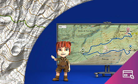
Height difference

The aim of this interactive teaching and learning resource is to learn to measure the distance between two geographical points on a map and to find out the height difference and the slope between them. With a chosen starting point and destination point, the contour lines are interpreted and a simple calculation is made. Aimed at students aged from 10 to 14 years. https://www.ign.es/recursos-educativos/descubre-territorio/desnivel.html
Área de coñecementoContexto educativo -
El desnivel
Este recurso interactivo y didáctico tiene como objetivo aprender a medir sobre un mapa la distancia entre dos puntos geográficos y conocer el desnivel y la pendiente que existe entre ellos. Con un punto de partida y otro de llegada elegidos, se interpretan las curvas de nivel y se realiza un sencillo cálculo. Dirigido a estudiantes de edades entre 10 y 14 años. Actualizado en 2020. También se ofrece este recurso en inglés. https://www.ign.es/recursos-educativos/descubre-territorio/d...
Área de coñecementoContexto educativo -
Orienteering
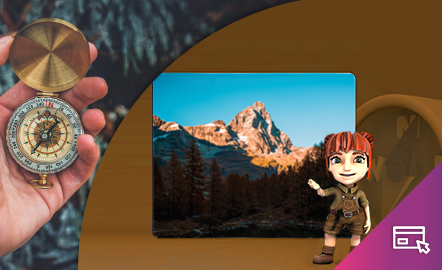
The aim of this interactive teaching and learning resource is to introduce the user, through entertaining activities, to the use of a basic instrument for geographical orienteering, the compass. The method followed consists of setting small challenges that are easily answered, with the aim of favouring the learning process. Aimed at students aged from 10 to 12 years. https://www.ign.es/recursos-educativos/descubre-territorio/brujula.html
Área de coñecementoContexto educativo -
Orientación

Este recurso interactivo didáctico está encaminado a iniciar al usuario de manera lúdica en la aplicación de un instrumento básico para la orientación geográfica como es la brújula. El método que se sigue consiste en plantear pequeños retos fáciles de responder con el objetivo de favorecer el aprendizaje. Dirigido a estudiantes de edades entre 10 y 12 años. Actualizado en 2020. https://www.ign.es/recursos-educativos/descubre-territorio/brujula.html
Área de coñecementoContexto educativo -
Drawing a map

The aim of this interactive teaching and learning resource is to introduce the learner to map-making. A photograph is used as an informative medium related to reality, to transform it into a cartographic product of an abstract nature. The activity consists of defining geographical spaces and identifying the elements and characteristics of the local landscape. Aimed at students aged from 10 to 12 years. https://www.ign.es/recursos-educativos/descubre-territorio/corocromatico.html
Área de coñecementoContexto educativo