ARTIKULUAK
-
Orientation in the field with map, compass and apps
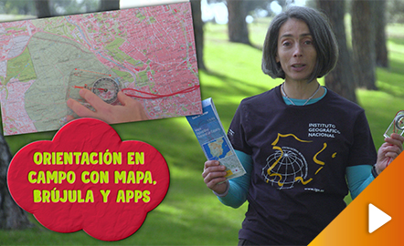
This video shows how to orient yourself in the field in a traditional way through the use of a map and a compass, and through the use of map applications for mobile devices. The video includes a test as a quiz to check what has been learned, which can be found in the descriptive text located below it. https://www.youtube.com/watch?v=xE4edPN3OEo&feature=youtu.be
Jakintza-arloHezkuntza-testuingurua -
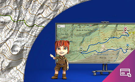
Height difference

The aim of this interactive teaching and learning resource is to learn to measure the distance between two geographical points on a map and to find out the height difference and the slope between them. With a chosen starting point and destination point, the contour lines are interpreted and a simple calculation is made. Aimed at students aged from 10 to 14 years. https://www.ign.es/recursos-educativos/descubre-territorio/desnivel.html
Jakintza-arloHezkuntza-testuingurua -
El desnivel
Este recurso interactivo y didáctico tiene como objetivo aprender a medir sobre un mapa la distancia entre dos puntos geográficos y conocer el desnivel y la pendiente que existe entre ellos. Con un punto de partida y otro de llegada elegidos, se interpretan las curvas de nivel y se realiza un sencillo cálculo. Dirigido a estudiantes de edades entre 10 y 14 años. Actualizado en 2020. También se ofrece este recurso en inglés. https://www.ign.es/recursos-educativos/descubre-territorio/d...
Jakintza-arloHezkuntza-testuingurua -
Orienteering
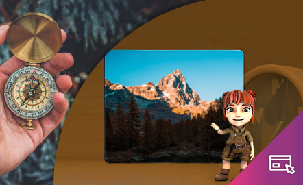
The aim of this interactive teaching and learning resource is to introduce the user, through entertaining activities, to the use of a basic instrument for geographical orienteering, the compass. The method followed consists of setting small challenges that are easily answered, with the aim of favouring the learning process. Aimed at students aged from 10 to 12 years. https://www.ign.es/recursos-educativos/descubre-territorio/brujula.html
Jakintza-arloHezkuntza-testuingurua -
Orientación

Este recurso interactivo didáctico está encaminado a iniciar al usuario de manera lúdica en la aplicación de un instrumento básico para la orientación geográfica como es la brújula. El método que se sigue consiste en plantear pequeños retos fáciles de responder con el objetivo de favorecer el aprendizaje. Dirigido a estudiantes de edades entre 10 y 12 años. Actualizado en 2020. https://www.ign.es/recursos-educativos/descubre-territorio/brujula.html
Jakintza-arloHezkuntza-testuingurua -
Preparamos nuestra excursión final de curso

Es una unidad didáctica en la que se incluyen diferentes tareas a realizar por los alumnos y alumnas de sexto curso a la hora de preparar su excursión final de curso
Jakintza-arloHezkuntza-testuingurua -
Excursión fin de curso
UDI en la que se progrmana diferentes tareas relacionadas con este tema y para distitnas áreas.
Jakintza-arlo -
UDI: Excursión final de curso
UDI que engloba diferentes tareas relacionadas con este tema y para diferentes áreas de 6º de Primaria
Jakintza-arlo