Elevation
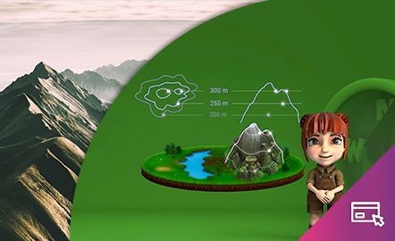
This interactive teaching and learning resource helps us to discover the third dimension in mapping. The use of contour lines enables us to represent relief and to read it as a key element in mapping. The method used consists of setting small challenges that are easily answered, with the aim of favouring the learning process.
Aimed at students aged from 12 to 16 years.
https://www.ign.es/recursos-educativos/descubre-territorio/altitud.html