PROCOMÚN
Mostrando resultados 1 a 11 de un total de 11
-
GeoExplorer
 GeoExplorer has come to discover the Earth through games to learn astronomy, the interior of the Earth, geography and maps. Draw, colour, cut and learn more with links to other resources. Aimed at students aged from 6 to 12 years. https://www.ign.es/web/resources/acercaDe/libDigPub/Geoexplorer_en.pdf
- mapa
- libro
- astronomía
- tierra
- terremoto
- volcán
- volcanes
- dibujo
- dibujar
- colorear
- recortar
- actividad
- cartografía
- Geografía
- juego
- jugar
- mapa
- país
- província
- región
- gamificación
- continente
- mundo
- mundial
- río
- montaña
- cordillera
- Física
- política
- bandera
- placas tectónicas
- Litosfera
- pico
- cabo
- Golfo
- isla
- archipiélago
- capital
- ciudad
- infantil
- Primaria
Área de conocimientoContexto educativo -
GeoSapiens App
 GeoSapiens tests your knowledge of physical, political and landscape geography. Review the names of the main features of land and coastal relief, countries, capitals, regions, flags and much more. It contains games from Spain, by autonomous region, the world and by continent. Play, score points and share your results. Suitable for all ages. English and Spanish. https://www.ign.es/web/ign/portal/dir-aplicaciones-moviles
- ign
- aplicación
- app
- juego
- jugar
- gamificación
- Geografía
- cartografía
- mapa
- comunidad
- autónoma
- país
- província
- región
- regiones
- capital
- Capitales
- municipio
- territorio
- continente
- mundo
- mundial
- río
- relieve
- montaña
- cordillera
- Lago
- Embalse
- Física
- política
- bandera
- Cuenca
- hidrografía
- placas tectónicas
- fosa
- dorsal
- costa
- costero
- pico
- cabo
- Golfo
- isla
- archipiélago
- ciudad
- Zonas
- parque nacional
- natural
- protegido
- regional
- rural
- paisaje
Área de conocimientoContexto educativo -
GeoSapiens App
 Aplicación móvil de mapas interactivos para estudiar la geografía física, política y el paisaje de España y el mundo. Es bilingüe en español e inglés y la mayoría de los juegos no requieren conexión a internet. Repasa los nombres de los principales accidentes del relieve terrestre y costero, los países, capitales, regiones, banderas y mucho más. Contiene juegos de España, por comunidad autónoma, del mundo y por continente. Juega y suma puntos. Dirigido a todas las edades. En español e inglés....
- ign
- aplicación
- app
- juego
- jugar
- gamificación
- Geografía
- cartografía
- mapa
- comunidad
- autónoma
- país
- província
- región
- regiones
- capital
- Capitales
- municipio
- territorio
- continente
- mundo
- mundial
- río
- relieve
- montaña
- cordillera
- Lago
- Embalse
- Física
- política
- bandera
- Cuenca
- hidrografía
- placa
- tectónica
- fosa
- dorsal
- costa
- costero
- pico
- cabo
- Golfo
- isla
- archipiélago
- ciudad
- Zonas
- proteger
- parque
- nacional
- natural
- regional
- rural
- paisaje
Área de conocimientoContexto educativo -
GeoSapiens
 GeoSapiens tests your knowledge of physical, political and landscape geography. Review the names of the main features of land and coastal relief, countries, capitals, regions, flags and much more. It contains games from Spain, by autonomous region, the world and by continent. Create your customized game and share it with your class. Play, score points and share your results. Suitable for all ages. https://educativo.ign.es/geosapiens/htm/es/index.html
- aplicación
- cartografía
- comunidad autónoma
- Geografía
- juego
- jugar
- mapa
- país
- província
- región
- regiones
- territorio
- gamificación
- continente
- mundo
- mundial
- río
- montaña
- cordillera
- Lago
- Embalse
- Física
- política
- bandera
- Cuenca
- hidrografía
- placa
- tectónica
- fosa
- dorsal
- costa
- costero
- pico
- cabo
- Golfo
- isla
- archipiélago
- capital
- ciudad
Área de conocimientoContexto educativo -
GeoSapiens
 GeoSapiens pone a prueba tus conocimientos sobre geografía física, política y paisaje. Repasa los nombres de los principales accidentes del relieve terrestre y costero, los países, capitales, regiones, banderas y mucho más. Contiene juegos de España, por comunidad autónoma, del mundo y por continente. Dirigido a todas las edades. También se ofrece este recurso en inglés. https://educativo.ign.es/geosapiens/htm/es/index.html
- aplicación
- cartografía
- comunidad autónoma
- Geografía
- juego
- jugar
- mapa
- país
- província
- región
- regiones
- territorio
- gamificación
- continente
- mundo
- mundial
- río
- cordillera
- Lago
- Embalse
- Física
- política
- bandera
- Cuenca
- hidrografía
- placa
- tectónica
- fosa
- dorsal
- costa
- costero
- pico
- cabo
- Golfo
- isla
- archipiélago
- capital
- ciudad
Área de conocimientoContexto educativo -
Map reading
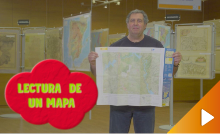 All the clues for understanding symbols, scale and relief of the National Topographic Map are in this video. The video includes a test as a quiz to check what has been learned, which can be found in the descriptive text located below it. https://youtu.be/kx2Bit8te1sÁrea de conocimientoContexto educativo
 -
Map symbols
 This interactive teaching and learning resource is aimed at introducing the user to map-making based on a photograph, an element that requires an abstract thought process. The elements are represented via symbols, designed by seeking the closest connection to the reality they are going to replace, taken from a photograph. The method used makes it possible to set small challenges that are easily answered, with the aim of favouring the learning process. Aimed at students aged from 10 to 14 y...Área de conocimientoContexto educativo
 -
Símbolos cartográficos
 Este recurso interactivo y didáctico está encaminado a iniciar al usuario en la elaboración cartográfica a partir de una fotografía, elemento que requiere un proceso cognitivo de abstracción. Los elementos se representan a través de símbolos, diseñados buscando la mayor conexión con la realidad a la que van a sustituir, recogida en una fotografía. El método utilizado permite plantear pequeños retos fáciles de responder con el objetivo de favorecer el aprendizaje. Dirigido a estudiantes de ...Área de conocimientoContexto educativo
 -
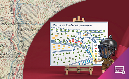
Interpretar un mapa
 El estudio de la distribución de los elementos permite conocer mejor el entorno en el que nos desenvolvemos y sacar el mayor provecho del mismo. Este material didáctico está encaminado a iniciar al usuario en la lectura de la representación cartográfica. El método utilizado permite plantear pequeños retos fáciles de responder con el objetivo de favorecer el aprendizaje. Dirigido a estudiantes de entre 10 y 12 años. Actualizado en 2020. También se ofrece este recurso en inglés. https:...Área de conocimientoContexto educativo
 -
Elevation
 This interactive teaching and learning resource helps us to discover the third dimension in mapping. The use of contour lines enables us to represent relief and to read it as a key element in mapping. The method used consists of setting small challenges that are easily answered, with the aim of favouring the learning process. Aimed at students aged from 12 to 16 years. https://www.ign.es/recursos-educativos/descubre-territorio/altitud.htmlÁrea de conocimientoContexto educativo
 -
La altitud
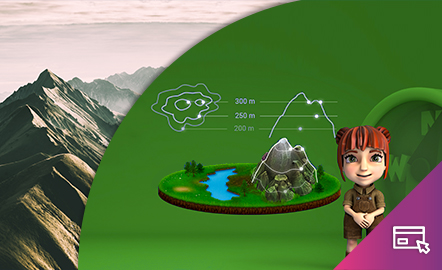 Este recurso interactivo y didáctico permite descubrir la tercera dimensión en la cartografía. La técnica de las curvas de nivel permite hacer la representación del relieve y la lectura del mismo como elemento clave en la cartografía. El método utilizado permite plantear pequeños retos fáciles de responder con el objetivo de favorecer el aprendizaje. Dirigido a estudiantes de entre 12 y 16 años. Actualizado en 2020. También se ofrece este recurso en inglés. https://www.ign.es/recu...Área de conocimientoContexto educativo