ARTÍCULOS
-
Drawing a map

The aim of this interactive teaching and learning resource is to introduce the learner to map-making. A photograph is used as an informative medium related to reality, to transform it into a cartographic product of an abstract nature. The activity consists of defining geographical spaces and identifying the elements and characteristics of the local landscape. Aimed at students aged from 10 to 12 years. https://www.ign.es/recursos-educativos/descubre-territorio/corocromatico.html
Área de conocimientoContexto educativo -
Map symbols
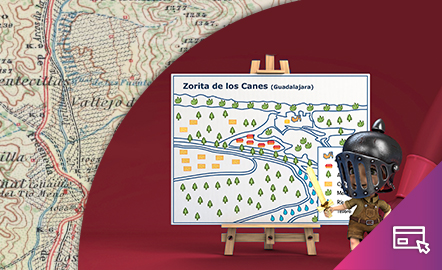
This interactive teaching and learning resource is aimed at introducing the user to map-making based on a photograph, an element that requires an abstract thought process. The elements are represented via symbols, designed by seeking the closest connection to the reality they are going to replace, taken from a photograph. The method used makes it possible to set small challenges that are easily answered, with the aim of favouring the learning process. Aimed at students aged from 10 to 14 y...
Área de conocimientoContexto educativo