ARTÍCULOS
-
Drawing a map

The aim of this interactive teaching and learning resource is to introduce the learner to map-making. A photograph is used as an informative medium related to reality, to transform it into a cartographic product of an abstract nature. The activity consists of defining geographical spaces and identifying the elements and characteristics of the local landscape. Aimed at students aged from 10 to 12 years. https://www.ign.es/recursos-educativos/descubre-territorio/corocromatico.html
Área de conocimientoContexto educativo -
Spain, 8,000 kilometres of coastline
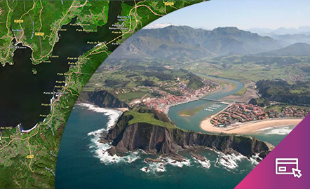
This interactive teaching and learning resource enable us to discover the coastal landforms of Spain, its landscapes and coastal accidents. Coastal features are described: bays, capes, lagoons, beaches, cliffs, coves, marshes, rias, estuaries, etc. On the one hand, geomorphological concepts are dealt with by looking at elements of coastal relief. On the other hand, the use of the National Geographic Information System (SignA), shows the Spain's natural and geomorphological heritage. Aimed ...
Área de conocimientoContexto educativo