ARTIGOS
-
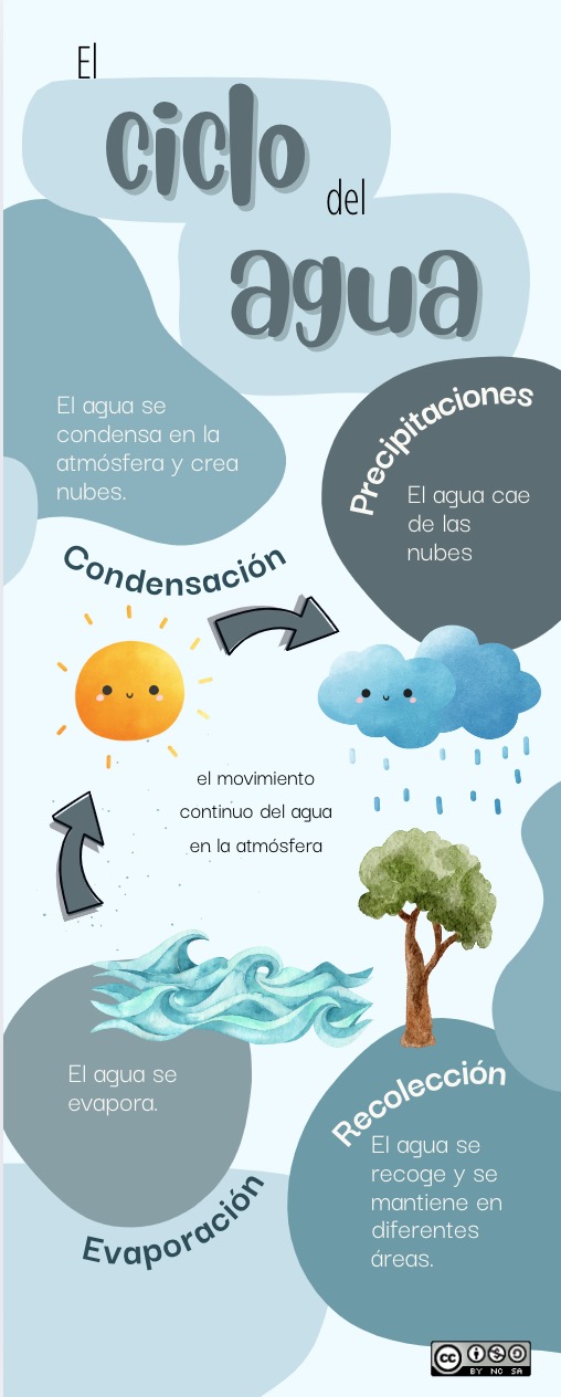
Infografía Análisis de un climograma
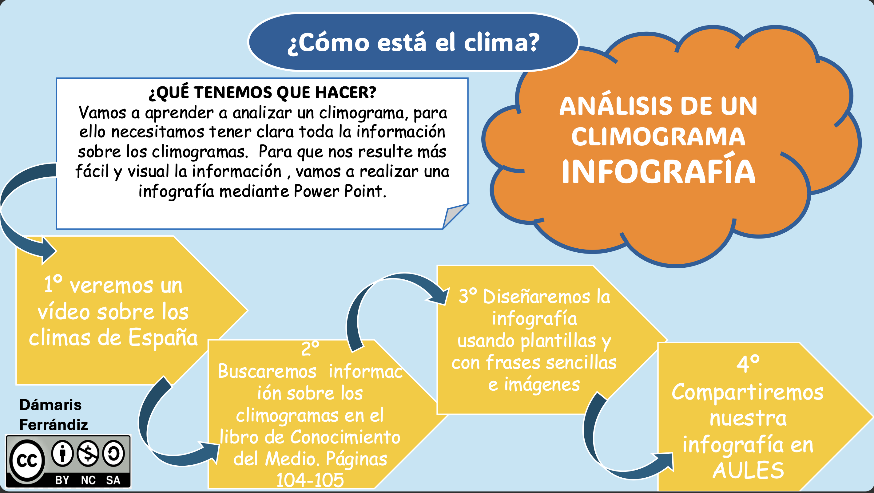
Infografía climogramas.pdf
Área de coñecementoContexto educativo -
EXPOESPAÑA
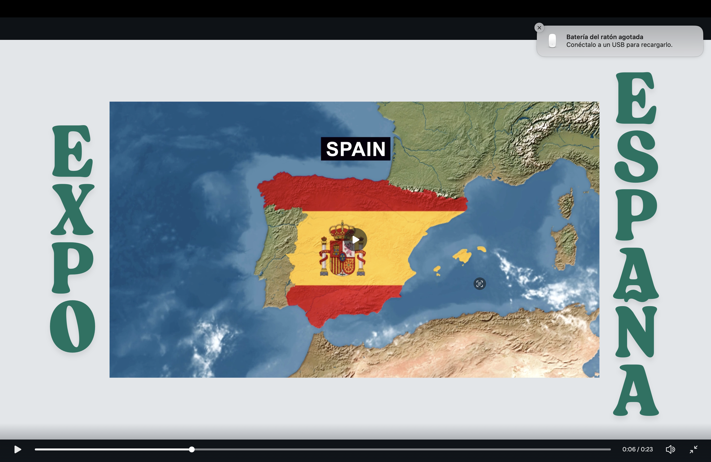
Este recurso es una presentación digital interactiva creada por el alumnado de sexto de primaria como parte del proyecto anual "La clase de los viajeros por España". Cada grupo ha investigado una comunidad autónoma y ha diseñado un “stand digital” que forma parte de una feria virtual llamada ExpoEspaña. El recurso contiene texto, imágenes, iconos, mapas, vídeos, y enlaces, todos organizados de forma creativa para mostrar aspectos culturales, climáticos, festivos y gastronómicos de cada com...
Área de coñecementoContexto educativo -
GeoExplorer

GeoExplorer has come to discover the Earth through games to learn astronomy, the interior of the Earth, geography and maps. Draw, colour, cut and learn more with links to other resources. Aimed at students aged from 6 to 12 years. https://www.ign.es/web/resources/acercaDe/libDigPub/Geoexplorer_en.pdf
- mapa
- libro
- astronomía
- tierra
- terremoto
- volcán
- volcanes
- dibujo
- dibujar
- colorear
- recortar
- actividad
- cartografía
- Geografía
- juego
- jugar
- mapa
- país
- província
- región
- gamificación
- continente
- mundo
- mundial
- río
- montaña
- cordillera
- Física
- política
- bandera
- placas tectónicas
- Litosfera
- pico
- cabo
- Golfo
- isla
- archipiélago
- capital
- ciudad
- infantil
- Primaria
Área de coñecementoContexto educativo -
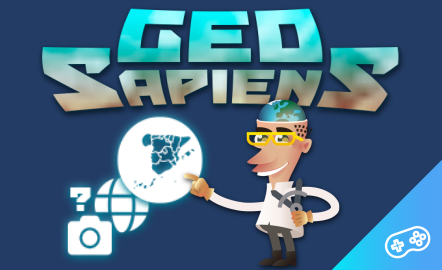
GeoSapiens App

GeoSapiens tests your knowledge of physical, political and landscape geography. Review the names of the main features of land and coastal relief, countries, capitals, regions, flags and much more. It contains games from Spain, by autonomous region, the world and by continent. Play, score points and share your results. Suitable for all ages. English and Spanish. https://www.ign.es/web/ign/portal/dir-aplicaciones-moviles
- ign
- aplicación
- app
- juego
- jugar
- gamificación
- Geografía
- cartografía
- mapa
- comunidad
- autónoma
- país
- província
- región
- regiones
- capital
- Capitales
- municipio
- territorio
- continente
- mundo
- mundial
- río
- relieve
- montaña
- cordillera
- Lago
- Embalse
- Física
- política
- bandera
- Cuenca
- hidrografía
- placas tectónicas
- fosa
- dorsal
- costa
- costero
- pico
- cabo
- Golfo
- isla
- archipiélago
- ciudad
- Zonas
- parque nacional
- natural
- protegido
- regional
- rural
- paisaje
Área de coñecementoContexto educativo -
GeoSapiens App
Aplicación móvil de mapas interactivos para estudiar la geografía física, política y el paisaje de España y el mundo. Es bilingüe en español e inglés y la mayoría de los juegos no requieren conexión a internet. Repasa los nombres de los principales accidentes del relieve terrestre y costero, los países, capitales, regiones, banderas y mucho más. Contiene juegos de España, por comunidad autónoma, del mundo y por continente. Juega y suma puntos. Dirigido a todas las edades. En español e inglés....
- ign
- aplicación
- app
- juego
- jugar
- gamificación
- Geografía
- cartografía
- mapa
- comunidad
- autónoma
- país
- província
- región
- regiones
- capital
- Capitales
- municipio
- territorio
- continente
- mundo
- mundial
- río
- relieve
- montaña
- cordillera
- Lago
- Embalse
- Física
- política
- bandera
- Cuenca
- hidrografía
- placa
- tectónica
- fosa
- dorsal
- costa
- costero
- pico
- cabo
- Golfo
- isla
- archipiélago
- ciudad
- Zonas
- proteger
- parque
- nacional
- natural
- regional
- rural
- paisaje
Área de coñecementoContexto educativo -
GeoSapiens

GeoSapiens tests your knowledge of physical, political and landscape geography. Review the names of the main features of land and coastal relief, countries, capitals, regions, flags and much more. It contains games from Spain, by autonomous region, the world and by continent. Create your customized game and share it with your class. Play, score points and share your results. Suitable for all ages. https://educativo.ign.es/geosapiens/htm/es/index.html
- aplicación
- cartografía
- comunidad autónoma
- Geografía
- juego
- jugar
- mapa
- país
- província
- región
- regiones
- territorio
- gamificación
- continente
- mundo
- mundial
- río
- montaña
- cordillera
- Lago
- Embalse
- Física
- política
- bandera
- Cuenca
- hidrografía
- placa
- tectónica
- fosa
- dorsal
- costa
- costero
- pico
- cabo
- Golfo
- isla
- archipiélago
- capital
- ciudad
Área de coñecementoContexto educativo -
GeoSapiens
GeoSapiens pone a prueba tus conocimientos sobre geografía física, política y paisaje. Repasa los nombres de los principales accidentes del relieve terrestre y costero, los países, capitales, regiones, banderas y mucho más. Contiene juegos de España, por comunidad autónoma, del mundo y por continente. Dirigido a todas las edades. También se ofrece este recurso en inglés. https://educativo.ign.es/geosapiens/htm/es/index.html
- aplicación
- cartografía
- comunidad autónoma
- Geografía
- juego
- jugar
- mapa
- país
- província
- región
- regiones
- territorio
- gamificación
- continente
- mundo
- mundial
- río
- cordillera
- Lago
- Embalse
- Física
- política
- bandera
- Cuenca
- hidrografía
- placa
- tectónica
- fosa
- dorsal
- costa
- costero
- pico
- cabo
- Golfo
- isla
- archipiélago
- capital
- ciudad
Área de coñecementoContexto educativo -
Map reading
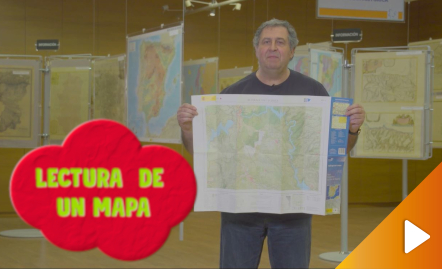
All the clues for understanding symbols, scale and relief of the National Topographic Map are in this video. The video includes a test as a quiz to check what has been learned, which can be found in the descriptive text located below it. https://youtu.be/kx2Bit8te1s
Área de coñecementoContexto educativo -
Los volcanes
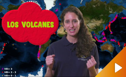
Un repaso a los tipos de erupciones, los materiales emitidos y las zonas volcánicas de España y el mundo a través de impactantes vídeos e imágenes. El vídeo tiene asociado un cuestionario a modo de juego para comprobar lo aprendido, cuyo enlace se puede consultar en el texto descriptivo ubicado bajo el mismo (haciendo clic en Mostrar más). https://youtu.be/46ait2dCuWw
Área de coñecementoContexto educativo -
El relieve litoral

Con este recurso interactivo y didáctico aprendemos el relieve costero de España. Conocer bien el litoral nos permite aprovechar mejor el espacio geográfico. Con ayuda de imágenes y juegos se enseña a identificar de forma interactiva los accidentes costeros: playas, acantilados, rías, bahías, albuferas, etc. Dirigido a estudiantes de edades de entre 10 y 16 años. Actualizado en 2020. También se ofrece este recurso en inglés. https://www.ign.es/recursos-educativos/descubre-territorio...
Área de coñecementoContexto educativo -
Height difference

The aim of this interactive teaching and learning resource is to learn to measure the distance between two geographical points on a map and to find out the height difference and the slope between them. With a chosen starting point and destination point, the contour lines are interpreted and a simple calculation is made. Aimed at students aged from 10 to 14 years. https://www.ign.es/recursos-educativos/descubre-territorio/desnivel.html
Área de coñecementoContexto educativo -
El desnivel
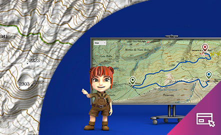
Este recurso interactivo y didáctico tiene como objetivo aprender a medir sobre un mapa la distancia entre dos puntos geográficos y conocer el desnivel y la pendiente que existe entre ellos. Con un punto de partida y otro de llegada elegidos, se interpretan las curvas de nivel y se realiza un sencillo cálculo. Dirigido a estudiantes de edades entre 10 y 14 años. Actualizado en 2020. También se ofrece este recurso en inglés. https://www.ign.es/recursos-educativos/descubre-territorio/d...
Área de coñecementoContexto educativo -
Orienteering
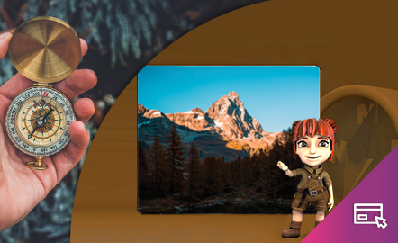
The aim of this interactive teaching and learning resource is to introduce the user, through entertaining activities, to the use of a basic instrument for geographical orienteering, the compass. The method followed consists of setting small challenges that are easily answered, with the aim of favouring the learning process. Aimed at students aged from 10 to 12 years. https://www.ign.es/recursos-educativos/descubre-territorio/brujula.html
Área de coñecementoContexto educativo -
Orientación

Este recurso interactivo didáctico está encaminado a iniciar al usuario de manera lúdica en la aplicación de un instrumento básico para la orientación geográfica como es la brújula. El método que se sigue consiste en plantear pequeños retos fáciles de responder con el objetivo de favorecer el aprendizaje. Dirigido a estudiantes de edades entre 10 y 12 años. Actualizado en 2020. https://www.ign.es/recursos-educativos/descubre-territorio/brujula.html
Área de coñecementoContexto educativo -
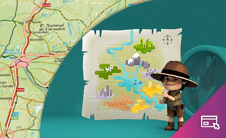
Drawing a map

The aim of this interactive teaching and learning resource is to introduce the learner to map-making. A photograph is used as an informative medium related to reality, to transform it into a cartographic product of an abstract nature. The activity consists of defining geographical spaces and identifying the elements and characteristics of the local landscape. Aimed at students aged from 10 to 12 years. https://www.ign.es/recursos-educativos/descubre-territorio/corocromatico.html
Área de coñecementoContexto educativo -
Dibujar un mapa
Este recurso interactivo y didáctico tiene como objetivo introducir al alumno en la elaboración cartográfica. Se recurre a una fotografía como soporte informativo relacionado con la realidad, para transformarla en un producto cartográfico de naturaleza abstracta. La actividad consiste en delimitar espacios geográficos e identificar los elementos y características del paisaje local. Dirigido a estudiantes de entre 10 y 12 años. Actualizado en 2020. https://www.ign.es/recursos-educativos...
Área de coñecementoContexto educativo -
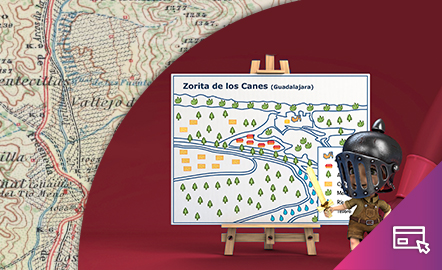
Geographical names
This interactive teaching and learning resource looks at the importance of geographical names in the representation of territory. On maps, toponyms, in addition to identifying and locating places, give us information according to the size, colour and type of letters used. The method used makes it possible to set small challenges that are easily answered, with the aim of favouring the learning process. Aimed at students aged from 10 to 12 years. https://www.ign.es/recursos-educativos/de...
Área de coñecementoContexto educativo -
Topónimos

Este recurso interactivo y didáctico incide en la importancia de los nombres geográficos en la representación del territorio. En los mapas, los topónimos, además de identificar y localizar los lugares, nos dan información según el tamaño y el color y el tipo de letra utilizados. El método utilizado permite plantear pequeños retos fáciles de responder con el objetivo de favorecer el aprendizaje. Dirigido a estudiantes de 10 a 12 años. Actualizado en 2020. También se ofrece este recurso ...
Área de coñecementoContexto educativo -
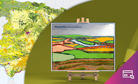
Map symbols
This interactive teaching and learning resource is aimed at introducing the user to map-making based on a photograph, an element that requires an abstract thought process. The elements are represented via symbols, designed by seeking the closest connection to the reality they are going to replace, taken from a photograph. The method used makes it possible to set small challenges that are easily answered, with the aim of favouring the learning process. Aimed at students aged from 10 to 14 y...
Área de coñecementoContexto educativo