Proiektu bat logo Gobierno de España - Ministerio de Educación y Formación Profesional Logo Intef - Instituto Nacional de Tecnología y Formación del Profesorado
hizkuntza
  • Español
  • Inglés
  • Catalán
  • Gallego
  • Vasco

Help

Laguntza
  • Uso-eskuliburua
  • Kontaktu

User account menu

  • Saioa hasi
  • Registrarse

logotipo Procomún

Ver filtros
Hide filters

Iragazi

Jakintza-arlo

  • Geografía (1)

Etiquetas

  • Mostrar todos (15)
  • (-) interpretar (1)
  • (-) norte (1)
  • cartela (1)
  • cartografía (1)
  • Cota (1)
  • curva (1)
  • escala (1)
  • mapa (1)
  • mtn (1)
  • nacional (1)
  • nivel (1)
  • plano (1)
  • representación (1)
  • símbolo (1)
  • territorio (1)

Hezkuntza-testuingurua

  • Mostrar todos (1)
  • (-) Educación Primaria (1)

Tipo

  • Artículos (1)

PROCOMÚN

Emaitzak erakusten 1 1 1 guztira
  • Map reading

    Artículo
    15/01/2025Instituto Geográfico Nacional - Centro Nacional Información Geográfica (CNIG)
    Resource image
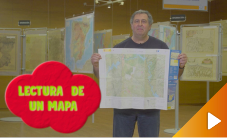
    All the clues for understanding symbols, scale and relief of the National Topographic Map are in this video. The video includes a test as a quiz to check what has been learned, which can be found in the descriptive text located below it. https://youtu.be/kx2Bit8te1s
    • mapa
    • cartografía
    • plano
    • topográfico
    • nacional
    • representación
    • escala
    • símbolo
    • cartela
    • norte
    • mtn
    • territorio
    • curva
    • nivel
    • Cota
    • interpretar
    Jakintza-arlo
    • Geografía
    Hezkuntza-testuingurua
    • Educación Primaria

APP Procomún

icono procomun

App store Google play

Our socials network

Facebook Twitter Youtube
  • About
  • Legal conditions
  • Terms of privacy
  • Cookies policy
  • Accessibility
  • Sitemap

Kontaktu